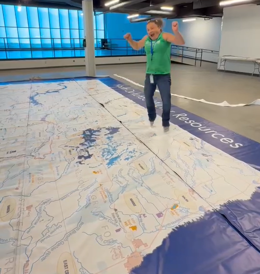
We’re excited to announce the arrival of our brand-new 20 ft x 30 ft map of North Dakota’s waterways—a stunning, large-scale educational tool designed to transform how students and visitors engage with the state’s natural environment. This oversized, durable, and transportable map will bring conservation and STEM education to life in a whole new way, offering hands-on learning opportunities that help deepen understanding of North Dakota’s unique waterways and ecosystems. Thanks to generous support from the North Dakota Natural Resources Trust.
Designed for Adventure
The map was created using up-to-date data from the North Dakota Department of Water Resources and was printed locally to ensure the highest quality and durability. Designed for both indoor and outdoor use, this giant map is perfect for multiple settings: it will be a highlight in the (soon to open) Outdoor Explorium, featured in our summer camps, incorporated into the Gateway to Science on the Go outreach program, and showcased at various community events throughout the state.
Hands-On Learning for All Ages
Our goal is to engage students from pre-K through high school with immersive, hands-on lessons that explore critical conservation topics. Using the map, students will learn to:
- Read and interpret maps using longitude and latitude coordinates
- Understand watersheds and their importance in managing water resources
- Identify invasive species and explore their impact on local ecosystems
- Discover the geological history that shaped North Dakota’s landscape
The map offers a tactile, visual experience that brings these concepts to life in a way textbooks cannot.
Empowering Educators and Students
Annie Beck, our outdoor education specialist with extensive experience in nature-based teaching, has been instrumental in developing programming around the map. “This map is more than just a visual aid,” Annie explains. “It allows students to literally walk across North Dakota, seeing how water moves through our state and understanding how interconnected our ecosystems really are. It’s a powerful way to foster environmental stewardship and critical thinking.”
Long-Term Impact
This map and its accompanying curriculum will be integrated into Gateway to Science’s programming, which reaches thousands of students annually. It will help us extend hands-on conservation education throughout rural communities via our On the Go program, while enhancing learning experiences in our facility’s Outdoor Explorium and summer camps.